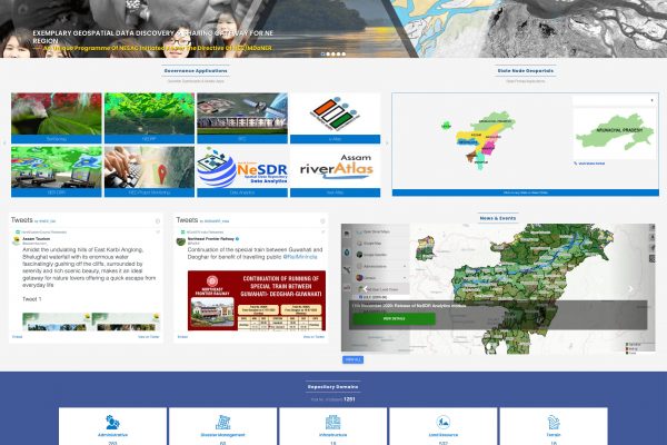
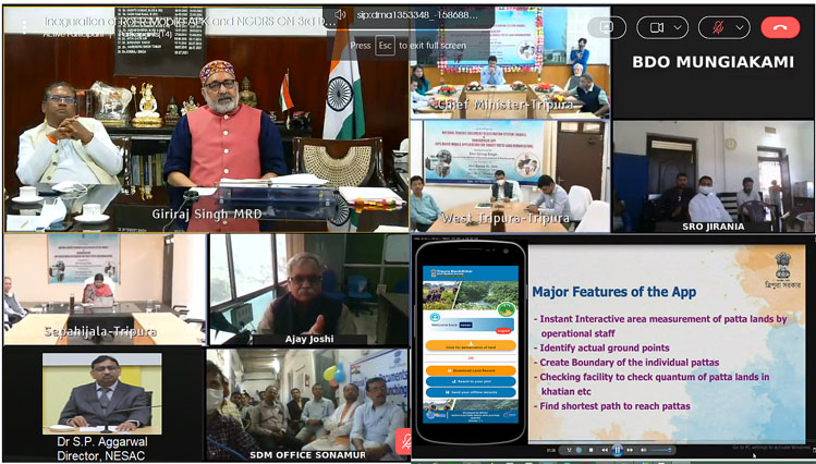
The North Eastern Spatial Data Repository (NeSDR), a project based on the establishment of NER Remote Sensing and GIS Resource Network was formally released on 11th November, 2020 at NESAC by Shri K Moses Chalai, IAS, Secretary, North Eastern Council. He was accompanied by six of his senior officials including Shri C.H Kharshiing, Planning Adviser, NEC. The meeting was also attended by the Directors of all State Remote Sensing Centres (SRSACs) of NER. Several senior scientists from ISRO have also participated during the official launch. The NeSDR Geoportal hosted at https://www.nesdr.gov.in is populated with 1226 vector datasets pertaining to land, water, administrative, terrain, action plan, infrastructure, weather and climate, utilities, disaster support inputs of NE states etc. It provides the datasets as per OGC standards for visualisation via web services. The interface has been designed to be more responsive in all kinds of platforms and devices. It’s a single window platform for seamless data accessibility across various users for data visualisation, interactive analysis, search and discovery of spatial based user’s interest. About 35 user groups from academia and government departments have been actively using the database of NeSDR. NeSDR also provides a platform for hosting Governance applications of various Government Departments to empower planning and monitoring activities. As of date, a total of 26 dashboards and 25 Mobile Apps for Governance Applications have been developed for the various Government User Departments of the region.
Additionally NeSDR Analytics is an in-house developed powerful geoprocessing platform for performing on-the-fly geospatial big data analytics. The platform incorporates a range of analytical tools like long term trend analytics, point data analysis, clustering and many more on top of the catalogued data. The application is designed to analyse the satellite images on-the-fly and produce the result as OGC compliant Web Map Service (WMS). The platform is catalogued with a collection of widely used geospatial datasets. The bulk of the catalogue is made up of Earth-observing remote sensing imagery, including the archive of MODIS and INSAT datasets pertaining to NER along with certain cloud free scenes LANDSAT and Sentinel-2. It also includes weather forecasts, land cover data and many other environmental, geophysical and socio-economic datasets. The catalogue is continuously updated with geospatial data from active missions. The analytics platform is built on an open-source stack and other enabling technologies that are widely used within the geospatial domain; it is implemented using python programming language. The Geo-processing framework consists of a library of a large number of functions, ranging in complexity from simple mathematical operations to powerful geostatistical, machine learning and image processing operations. Web-based raster calculator is also implemented and made accessible via a simple and easy to use user interface to enable users to perform custom operations. The platform has various modules for disseminating output of research and applications for various thematic areas like; Web-GIS vegetation monitoring system to monitor vegetation change and disturbances using long term vegetation index datasets, Monitoring Air quality using AOD (Aerosol Optical Depth) products from Satellite images, Assimilating rainfall from INSAT satellite data, Forest fire analytics using night light images, identifying the flood-affected areas using Near Real Time flood inundation rasters.


